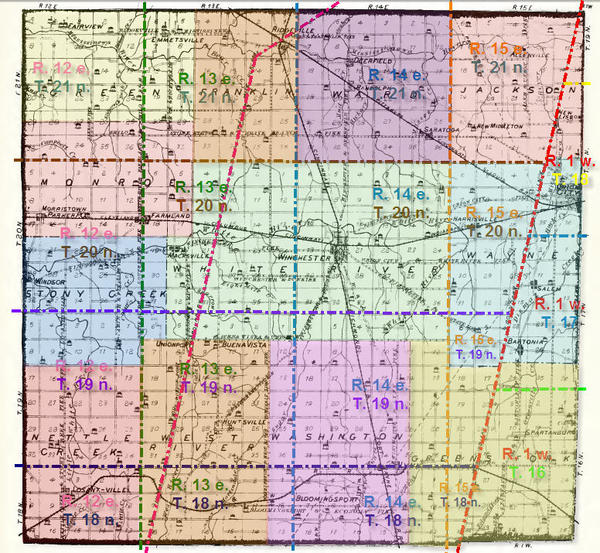
This map shows named townships (such as used in descriptions in the censuses). Each township is shaded a different color.
This map is derived from a map published in the book “1882 History of Randolph County, Indiana by E. Tucker with our compliments.
Connect